Aerial-survey sensor operators collect and check geospatial information from equipment carried in an aircraft. They are distinct from the pilot, a licensed land surveyor and a military intelligence sensor operator. The two verified examples concern civilian mapping. Some duties occur in an office or at ground equipment, so the job is more than observing scenery from a flight.
Educational reference · 27 October 2026. Educational reference — verify current requirements with the relevant authority. This is not a qualification, admission decision or operational publication.
Job-specific employer examples below are separate from the broad sector guides. They are selected evidence, not an application service, a live vacancy feed, worldwide eligibility rules or an assessment of your circumstances.
Specific employer examples
2
Supporting employer context sources
0
Evidence last checked
2026-10-27
Countries / scope represented
Canada; United States
Legal / licensing applicability
unresolved
Reference status
Educational reference — verify current requirements with the relevant authority.
Related job titles and aliases
Airborne sensor operator — civilian survey
Aerial data acquisition operator where duties align
Titles vary between employers; an alias does not make qualifications or duties interchangeable.
Where employers use this role
Aerial survey company
Geospatial services supplier
What the work involves
Collect and organise imagery or other survey data within trained responsibilities.
Check data completeness, quality and file traceability.
Coordinate with survey pilots, technical colleagues and clients without assuming the pilot’s authority.
Work settings
Survey aircraft, remote project locations, company bases and data-processing offices; travel and variable schedules depend on employer.
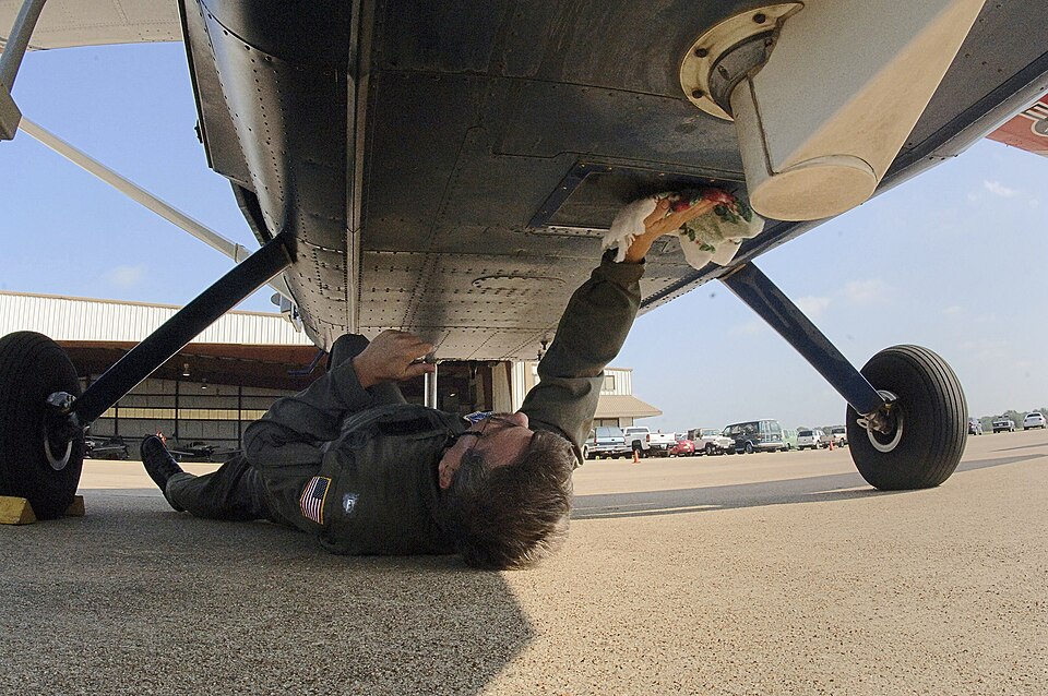
Illustrative photo. A crew member lies beneath a light aircraft and wipes a glass portal in its belly. The source identifies a remote-sensing installation, showing that specialist aircraft can carry optical surfaces outside the cockpit.
Illustrative role/sector context. This does not depict or verify the employers, vacancies, qualifications or countries discussed below.
Actual employer examples — keep each country and notice separate
Essential, desirable and other conditions retain the author’s source classification. An empty category means no separate requirement was established in the reviewed source, not that employers have no requirements. Historical or closed notices are examples, not current vacancies.
[EMP1] Kîsik Aerial Survey Inc. — Airborne Sensor Operator — Boundary Bay Airport
Explicit required education and experience kept separate from desired degree; repeated ideal wording disclosed.
Employer essential requirements
High-school diploma/equivalent and at least one year aerial-mapping/sensor-operation experience.
US work authorisation, driving licence and ability to obtain passport; computing, map-reading and equipment skills.
Employer desirable requirements
Earth-science or technical bachelor degree.
Other stated conditions
The page also calls prior sensor experience ideal despite listing one year as required; confirm the employer’s interpretation. Extended time in an aircraft is a stated work condition.
Duties supported by this example
Sensor data collection, quality checks and reports.
Selected conditions from this employer and role only; not a complete eligibility checklist or worldwide rule.
Official legal, licensing and occupational context
Employer preferences are not automatically law. Official guidance and occupational descriptions are not necessarily binding rules. Each source’s jurisdiction, scope and gaps below remain separate.
Occupational context; aircraft and survey-authority scope unresolved
BLS distinguishes technical mapping work from the separate progression to a licensed surveyor. Its broad guidance is not a determination of airborne-crew permissions. Pilot qualifications, company equipment authorisation and any professional sign-off on survey products must be checked separately for the operation and country.
Related technical occupation, education patterns and supervised learning.
Limitations
Broader occupation guidance, not an airborne-role personal licence or a Canadian qualification rule. It does not override either employer’s selected requirements.
Unresolved research and applicability
Two independent employers verified, with hiring status unconfirmed. Complete Canadian/US aircraft-crew and survey-profession applicability remains outside this guide.
Explore a possible entry route
Read the sensor and output scope before comparing vacancies. Civilian mapping, scientific remote sensing and defence surveillance can use similar titles but are not interchangeable employment or security pathways.
Develop genuine geospatial, computing and data-quality skills through relevant study and supervised projects. Note that the Canadian example accepts several qualification types while the US example makes a bachelor degree desirable rather than compulsory.
Ask how aircraft safety induction, equipment training, supervised deployment and quality checks are arranged. Clarify travel, variable hours and the boundary between sensor operation and pilot decisions before making a training commitment.
Learning exercises — not proof of professional competence
Use a small public non-sensitive map dataset to document file names, coordinate-reference information and missing metadata. Do not claim that a classroom map is an approved aviation survey product.
Create a data handover checklist for an invented research project: origin, date, version, known gaps and reviewer. This tests traceability, not live sensor-operating competence.
Preparation prompts — not reported interview questions
Preparation prompt: describe how you noticed and investigated a missing or inconsistent file. Explain how you preserved the original evidence and communicated uncertainty.
Prepare questions about equipment training, data-quality responsibilities, deployment patterns and the division of responsibility with the survey pilot. These are not reported employer questions.
Progression to investigate
Explore data-quality supervision, geospatial processing or project coordination. Licensed surveying, aircraft piloting and specialised sensor engineering require separate preparation and authority where applicable.
Scope and review limits
Educational requirements guide, not operational training, a professional approval or an employment guarantee. Educational reference — verify current requirements with the relevant authority.
Selected employer conditions are not worldwide eligibility rules. Read the complete current vacancy and competent authority requirements before choosing training or applying. No personal medical, immigration or employment eligibility assessment is made.
AI-assisted educational preparation. Source availability and hiring conditions can change. No personal data is collected, no application is sent, and no employment or eligibility outcome is promised.